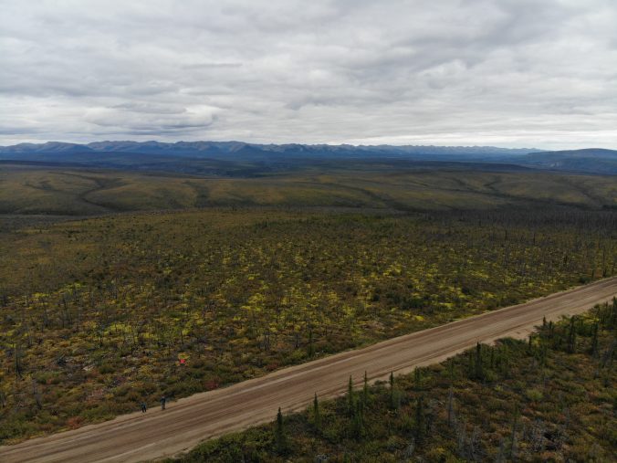
After an incredible two nights in Tombstone Territorial Park, we packed up and hit the Dempster Highway for real this time, starting our multi-day drive to the Arctic Ocean. The Dempster Highway is the only road in Canada that takes you across the Arctic Circle. This 737 km gravel road takes visitors through 10 of Canada’s 217 ecoregions, which are large areas of similar landform and climate with different ranges of plants, animals and soils. Prior to the trip my Uncle Craig mailed us a copy of the Dempster Highway Travelogue, and this little guide proved very useful informing us about neat features at various km markers along our route.
 For example, the travelogue informed us that Dall sheep reside along the mountainside at km 178.4. Their trails down the mountain to Engineer Creek are visible from the roadside, and we were able to spot three of them bedded down on the mountain with our binoculars. We were surprised by how white they were!
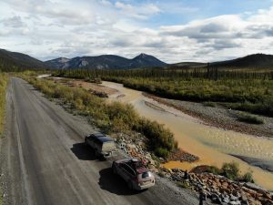
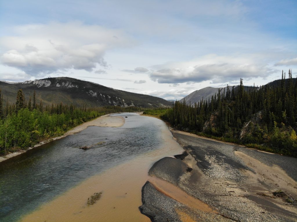
We stopped for a quick fish at km 195.5, where the distinctly red Engineer Creek meets the blue Ogilvie River. Antoine sent up the drone for some cool shots while I attempted to catch my first arctic grayling. No luck here either! 🙁 But views of the Ogilvie mountains made up for my poor fishing skills. This range of mountains differed from the Tombstone ranges, as they are comprised of light grey limestone rubble slopes and tall spikes of rocks known as tors. These are only found in unglaciated terrain! Here’s a shot of the Ogilvie-Peel viewpoint, which shows the northern fringe of these mountains. We couldn’t wait to return to this area on our way back down the Dempster for more fishing and some day hikes!
Engineer Creek meets the Ogilvie River
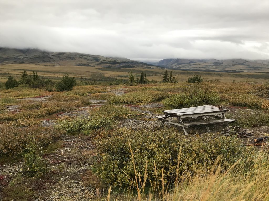
The driving got increasingly dicey as we left the Ogilvie River region and entered the Eagle Plain Plateau. It seemed that the maintenance crew forgot about this section of the road, with huge potholes and slick conditions slowing our drive to a crawl. There were also limited options for camping along the Eagle Plains portion of the highway. Paul had identified a nice spot near Eagle River at km 378 in his Garmin InReach, but it was rained out, with recent tire tracks indicating someone had been stuck. Rain was in the forecast for the next day, so we decided to camp further along at a gravel pit off the highway around km 387. We set up in our two vehicle T formation, with a tarp to keep us dry while we cooked delicious one pot meals on our camp stoves. In the evening we wandered back to the highway to snap some photos, picking Labrador leaves and rose hips for tea later on our drive.

Our gravel pit “campsite” in Eagle Plains
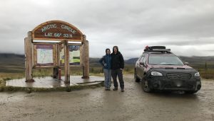 We woke up early the next morning prepared for a long day of driving to Inuvik, NWT. By 9:30am, we’d reached the Arctic Circle! The Mackenzie Mountains lay in front of us, shrouded by thick low lying clouds. We were a bit bummed as the views would have been epic, but at least it was rain and not snow! The clouds were even thicker and the wind even wilder once we reached the Yukon-NWT border at 10:30am. Oh wait, I mean 11:30!!! We were on Mountain Standard Time now – 1 hour ahead.
Arctic Circle viewpoint – Mackenzie Mountains hidden by cloud
 Highway conditions improved immensely once we reached NWT. We could now start travelling faster than 30km/h. We reached the first ferry crossing of the Dempster at the Peel River around noon on Tuesday August 21st. This cable ferry had been closed down the week prior for three days due to rain, so we were happy to find it functioning despite the inclement weather. In the winter the ferry is replaced by an ice bridge. After the short ferry ride we had a quick lunch in our vehicles thanks to continued rain at Nitainlai Territorial Park. We stopped shortly after for more snacks in Fort McPherson. This community of 900 sits between two ferry crossings on the Dempster. We were lucky to spot a spunky silver fox just outside of town. He was sporting a summer black coat with a white tail and skipped along the highway for quite some time while we sat parked watching. I wish I’d been able to capture a photo – he was beautiful and the first wildlife we’d seen in some time.
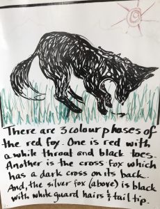
Description of local foxes at the Tombstone Interpretive Centre
The next ferry crossing at the Mackenzie River was even more beautiful, albeit a little slow with two stops including the community of Tsiigehtchic. The Arctic Red River joins the Mackenzie River near the ferry crossing. 2 hours later, we rolled onto the 12km stretch of paved highway that leads to Inuvik, NWT! According to our travelogue, Inuvik is Canada’s largest centre above the Arctic Circle, with a population of 3,400. That night we treated ourselves to dinner and a stay at Happy Valley Territorial Campground, centrally located in Inuvik. What it lacked in asthetic appeal, it made up for in amenities. Laundry and free hot showers! They were a welcome warm up before heading to bed in 1 degree temperatures. What more can you expect from the Arctic?!
Next up: the new road to Tuktoyaktuk and the Arctic Ocean!
Thanks for following along on our journey 🙂
Liz & Antoine
Are the walkie talkies coming in handy for the convoy?!
The walkie talkies were a hit!! Wildlife spotting, pee breaks and campsite searching were the primary uses. If we’re being honest it was the Liz and Nat chat line ha! Just wish we’d had 3 for when we were travelling with Derek and Jeni too 🙂 oh and the batteries were troublesome when it got super cold up north! 😛
glad to have you back where you can get internet access looking forward to hearing more stories and more pictures
Thanks Pat!! The posts are all written and scheduled to come out every 2-3 days now that we are back in cell range 🙂