We thought our days in the Ogilvie Mountains would be filled with fishing. We were naively planning a fish fry night for our first night there, as the Ogilvie River was calling our names and we were ready to slay arctic grayling. Unfortunately Mother Nature had different plans for us! We learned while stopped at the NWT-Yukon border that the Peel River ferry crossing closed due to high water levels. It seems we’d narrowly missed an extended stay in the North, having just crossed the river the day prior. The high water levels on the Peel River could also be seen in its tributary rivers, which includes the Ogilvie River and Engineer Creek. The waterways were barely recognizable from what we’d seen a few days prior on our journey north – they were rushing, high and extremely turbid. There would be no way for the fishies to see our lures in these conditions!
The weather was not cooperating either. We arrived at the Northern Ogilvie Mountains viewpoint to pouring rain. The skies were dark and showing no signs of stopping, so we set our sights on Engineer Creek campground. There were a few day hikes nearby that we were wanting to do, and we hoped that the weather would improve the next day. Nat and Paul sent out some satellite phone requests to friends for the latest forecast on the Dempster, and these sounded promising. But we’ve learned that weather forecasting in this region is less than stellar, so we had to take these with a grain of salt.
We set up camp at Engineer Creek, and made use of the kitchen shelter for dinner and socializing. There was a wood stove and good company! Most of the folks in the campground were on their way northbound and were disappointed to hear about the ferry closure. We were counting our lucky stars that we made it out. Sadly there are no photos of our time here thanks to the rain… It poured throughout the night and into the morning, and Engineer Creek rose significantly in the night. The rain stuck around for our breakfast preparations but finally abated around 10am, so we packed up camp and readied ourselves for a hike at nearby Sapper Hill.
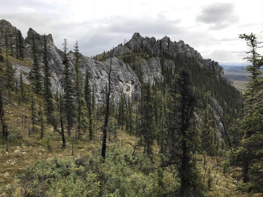
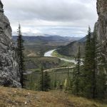
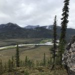
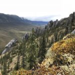
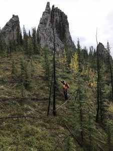 The campground sits below the Sapper Hill tores. These unique rock features are apparently filled with fossils. We parked at the Engineer Creek bridge and climbed upwards. The trail had turned into a creek, which made climbing rather interesting. Antoine’s boots are not waterproof, and so it was a rather wet hike for him. The views were worth it though! Everyone clambered to the top of one of the tors for a view of the valley, but my clumsiness and slight fear of heights got the best of me. We dined on Swiss chocolate cookies which Paul had earned that morning when he helped a couple from Switzerland retrieve their spare tire from under their truck.
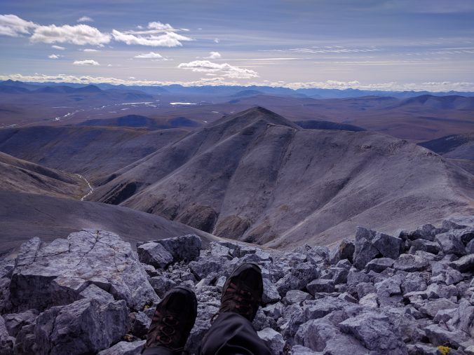
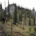
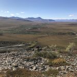
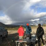
We ate a quick lunch in the parking lot after the hike, and hit the highway again with another hike in mind. During the drive Nat and Paul finally got to see their first grizzly bear munching greens on the side of the road. We watched for quite some time as she wandered the roadside, even crossing right in front of their truck for an epic photo opportunity. When she finally disappeared into the bushes we continued onward to Mount Distincta. At km 153 we parked the vehicles and walked onto the ridge of the mountain. Due to the location of the highway, you can instantly walk into the alpine zone for this hike!
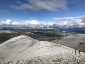
Storm clouds were threatening to the north, but there was blue sky beyond the grey so we pressed on. At one point we could no longer see the peak we were aiming for, but the skies eventually started to clear as we reached the top and we were one again treated to rainbows across the valley below. Slowly a gorgeous 360 degree view of the surrounding mountains and valleys began to reveal itself. This was a relatively gradual and extremely rewarding hike!
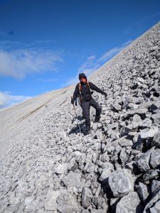 We decided to switch it up on our way down, heading for a different ridge. Paul continued to that peak, but midway we changed our minds and traversed back over to the other ridge across some unexpectedly dodgy rocks. As Nat described it, “It’s like surfing, but on rocks!”
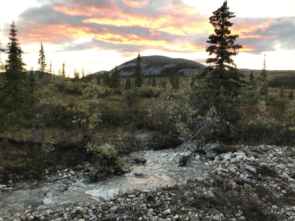
We made it back to the car shortly after Paul. He’d scouted out a gravel pit for us to camp in that night! Situated below the mountain we’d just hiked, it was spacious and serviced by a creek. There were also a number of abandoned pallets nearby so we made a makeshift fire pit and settled in for the night. We sat by the fire and planned our next hikes with the help of “Along the Dempster,” an awesome guidebook that my Uncle Craig sent to us before the trip. This was another memorable evening with great company!
With so many more mountains to explore, we went to bed early that night. The clouds were clearing as we settled into our vehicles, so I set my alarm for 1:30am in hopes of catching the northern lights. When the alarm went off Antoine told me we were clouded in, but I looked onto the horizon and spotted the telltale green lights. They stretched across the sky, dancing mainly in green but with a few flares of fuschia and purple. It was a frigid night though; ice formed on the dash of our car over night!
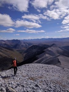
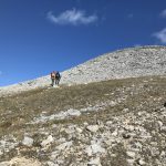
The next morning rocks in the stream were covered in a thin layer of ice. The sky was bluebird clear though, and we were excited for another day of hiking! We weren’t quite ready to leave the Ogilvie Mountains given the weather, but our options were somewhat limited due to the soggy tundra conditions. A chain of mountains at km 130.5 seemed to be accessible from the highway, with little tundra navigation required.
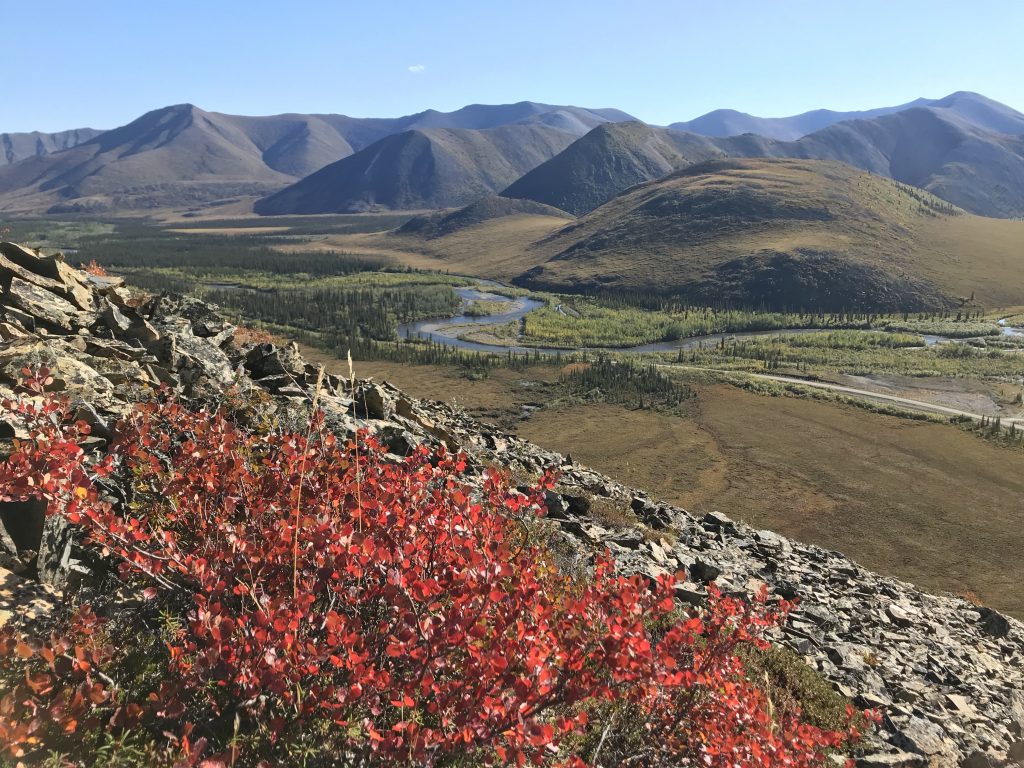
We started up Mt. Infant at around 11am. The clear skies provided us with stellar views of the 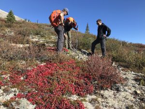 valleys around us, including the Blackstone River we’d camped and fished on during our northbound trip. Partway up the mountain we happened upon fresh scat, which Natalie hypothesized was 1 day old bear poo. Paul wasn’t so sure, but then we came across fresh root digging marks and thought we better not stick around. We hurried up past the tree line with thankfully no sign of the bear.
valleys around us, including the Blackstone River we’d camped and fished on during our northbound trip. Partway up the mountain we happened upon fresh scat, which Natalie hypothesized was 1 day old bear poo. Paul wasn’t so sure, but then we came across fresh root digging marks and thought we better not stick around. We hurried up past the tree line with thankfully no sign of the bear.
We made it to the summit of Mt. Infant around 1pm for our lunch break. We traded snacks with Paul and Nat to mix up our provisions: Cajun nut mix for Snyder’s Buffalo Preztel bites. We’ve gotten good at mixing up our snack options via wheeling and dealing this past week 😉
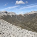
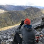
 We continued on for another 30 minutes, but Nat and I were ready for a break. Paul and Antoine continued on to the peak of Mt. Abraham which could be seen in the distance, while we relaxed on a mossy mountainside sheltered from the wind. I organized my photos and finished up this blog while Natalie took more photos. We watched the boys as they progressed to the top in 50 minutes! They’re a bunch of mountain goats, I swear 🙂 When reunited we shared a pop tart treat before descending the remaining ridges together. All in all, the boys hiked around 14km while Nat and I hiked 11km. It was an awesome day of hiking with epic weather.
Next up: our final day on the Dempster!
Liz & Antoine
-
- Sapper Hill
-
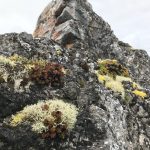
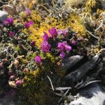
- Lichen on Sapper Hill
-
- View from the top
-
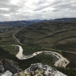
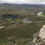
- Ogilvie River below Sapper Hill
-
- Ogilvie River
-
- Sapper Hill views
-
- Lichen at Sapper Hill
-

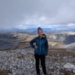
- Our photographer, Nat
-
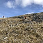
- Mt. Infant hike
-
- Valley views during Mt. Infant hike
-
- View of Mt. Abraham from Mt. Infant
-
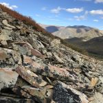
- Variety of rock types on Mt. Infant
-
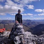
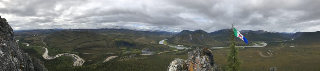
- Paul at the top of Mt. Abraham
-
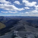
- Panorama from Mt. Abraham
-
- Liz on Mt. Distincta Ridge
-
- Wildflowers on Distincta Ridge
-
- Sunshine ahead
-
- Paul and Antoine looking for wildlife
-
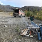
- Gravel pit campsite below Mt. Distincta ridge
-
- Rainbows, again!
What were those hills/mountains made of? Looks like big angular rocks, so not esker-like (rocks are round from the glacial water action)?
The Northern Ogilvies look a lot different from the Tombstone range, because they didn’t go through the latest period of glaciation. Here’s a quote that explains better than I can 😉 “The north portion consists of sedimentary rock that escaped the glaciation of the last ice age. They are old, greyish, heavily worn and have lots of talus and water cut valleys. Except for a few higher mountain summits, the terrain consists of flat-topped and rounded hills, which are eroded remnants of a former plain. They can be difficult to climb because there is so much scree and loose stones.”
Thanks sweets! CYA soon!
Hey Liz and crew! We have been home for a few days now from our most recent 10 day stint of off-grid time up at our camp, so I have finally had a chance to catch uo to you (metaphorically speaking) on your epic journey. SO wish we were making the trek with you – mosquitos, snow, rain, and all! But then, I guess we are due to your wonderfully detailed blog posts and awesome photos! Thanks SO much for allowing us to accompany you in spirit! Continued safe travels to you all.
Love, Janet